2017 Watershed Symposium Audience Questions & Answers
During the 2017 Watershed Symposium, we received a wide range of questions from the audience!
Due to the number of presenters and breadth of content covered, there was not enough time to address all of the questions received. We organized the questions by speaker or general topic and contacted our presenters for answers. Below are answers that we have received from our speakers so far. Check back again, as we will continue to update this page.
Speakers
- Renata Brillinger
- Richard Connon
- Karen Gaffney & Andrea MacKenzie
- Robin Grossinger
- Thomas Harter
- Jonathan Koehler
- Dan Logan
- Lester McKee
- Lisa Micheli
- Michelle Selmon
Renata Brillinger, CA Climate & Agriculture Network
As regards achieving the goals of AB32 and SB32, is state government proceeding with its planning along the lines of combining the two bills into one, or is each bill getting a separate set of plans?
"The bills are related in that they both established targets for reducing greenhouse gas (GHG) emissions statewide. AB 32 was passed in 2006 and set a target of reducing GHGs to 1990 levels by the year 2020. In 2016, SB 32 was passed and it extended the target to the year 2030 and requires GHGs to be reduced to 40% below 1990 levels. The details of each bill and how those targets will be met are different. In other words, the implementation of each bill varies and evolves. For example, there is an ongoing planning process that gets continually updated about every 3 years (called “scoping plans”), and there are a number of programs and funding mechanisms that also change."
Richard Connon, UC Davis
When there is coliform or E-coli within a waterway or creek - is there a way to cleanse that water before it enters the river?
"Fecal bacteria are generally controlled at the level of the wastewater treatment plant. Higher water temperatures increase the likelihood and potential for pathogen infections. Best solution is to control at source. I have limited expertise on E. coli and other fecal bacteria, but there are many experts at respective sanitation plants."
You said that toxic runoff from agriculture is less than urban areas. What strategies are agricultural industries using that have lessened toxic runoff?
"Agriculture follows more stringent rules with regards to use and applications, and many have buffer zones around the crop fields. Within urban areas, unless pesticides are applied professionally, there are little to no regulations. Many people use pesticides in their homes or yards to control a variety of pests such as insects, weeds and rodents, as well as apply pesticide products directly to their pets to control fleas and ticks. Many people think that more is better. An example that summarizes this for me occurred last year, when I was camping: campers in the neighboring site emptied a whole can of insect killer spray around their tent because “bugs” were getting in (so much with exploring nature!)."
From the WICC: The best option is to limit the use of toxic chemicals whenever possible or seek less toxic alternatives. Source control is always preferred over runoff treatment. A well-known practice used to cleanse potentially toxic runoff from entering nearby waterways is the installation of grassy buffers and swales within our neighborhoods and agricultural areas to slow and clean surface runoff. Grass swales and buffers are graded landscapes with water tolerant plants through which runoff passes. These areas allow for pollutants to be removed from the runoff through infiltration. To learn more about grass swales and how they can help keep pollutants from entering our waterways see the Slow It, Spread It, Sink It! pamphlet.
The key to preventing toxic runoff is awareness. Be aware of the type and amount of chemical used (fertilizer, pesticide, cleaner, …) on your lawns or around your home. Do not fertilize your landscape before a rain event or before watering, the nutrients will not absorb into the ground quickly enough and will be swept away by overland runoff. All fertilizers should be environmentally friendly and used sparingly. Visit Napa County’s Pesticide Safety Program page to learn more. Another simple way to help prevent toxic runoff is to pick up and properly dispose of your pet’s waste.
When considering the various non-point sources and the lack of data on urban/household chemical use, how can Napa County design an effective monitoring program, with reliable indicators? Are there models we can follow? Where do we begin?
"There are a number of model species used in toxicological assessments. Most common assessments have a three tier indicator organism approach that includes algal, invertebrate and fish (e.g., green alga, daphnia spp (water fleas), and fathead minnow or rainbow trout. The US EPA has a number of protocols for toxicity testing. E.g., whole effluent toxicity (WET) https://www.epa.gov/cwa-methods/whole-effluent-toxicity-methods. There are several laboratories in California that can conduct these tests. The aquatic toxicology laboratory at UC Davis is a state registered lab and uses US EPA protocols."
From the WICC: Typical water quality parameters that are measured in streams/rivers are temperature, dissolved oxygen, pH, salinity, alkalinity, ammonium, turbidity. These are all standard physicochemical parameters, which give an indication of water suitability and alert researchers to potential changes in the water chemistry. Monitoring for chemical constituents(particularly emerging compounds) can be very complicated and costly. An assemblage of local, state, federal and academic experts on monitoring program development and application would need to be consulted to establish an effective design and implementation program.
There is increased discussion about gender diversity in humans, your thought about relation to your research?
"Gender diversity has existed across human history, long before the use of synthetic chemicals. I’d like to stress that gender is about who the person is and not about what may have caused it, please do not confuse gender diversity and sexual preference with hormonal imbalance. That said, hormonal changes can and do occur from exposure to synthetic hormones and hormone mimics, and much research is being conducted within the medical field as well as in environmental toxicology. Exposure to estrogens or androgens during a critical period of development can for example change sexual behavior, but there are multiple mechanisms behind this outcome are being researched."
How much help is needed by the municipal reservoirs to prevent water quality degradation?
From the WICC: Periodic surveys and monitoring are performed by the cities to determine water quality in the reservoirs. The City of Napa and the County are engaging in a joint effort to study the Milliken and Hennessey watersheds to better inform the science of those two water bodies.
Should urban run-off be channeled to water treatment like other waste rather than going directly into the river?
From the WICC: It is technically feasible to treat stormwater along with wastewater and some cities such as San Francisco have so-called combined systems which treat both. However, in cities like Napa wastewater and stormwater systems were designed to be separate and diverting stormwater to a water treatment plant would be prohibitively expensive because the volume of stormwater generated is orders of magnitude larger than wastewater. Moreover, even advanced water treatment plants are not able to remove all pollutants (e.g. pesticides and pharmaceuticals). One of the best methods for stormwater treatment is called bioretention. Also referred to as Green Infrastructure or Low Impact Development, it involves diverting stormwater into onsite treatment systems consisting of a special soil mix and planted with appropriate plants. The soil serves as a filter for pollutants and allows for infiltration. For more information download the “Slow It, Spread It, Sink It” manual.
Please advise the public of the new pollution listings of the Napa River; DDT, PCP, chlordane, by the SFRWQCB for the (303) (d) CWA list.
From the WICC: State and Regional Water Boards assess water quality monitoring data for California’s surface waters every two years to determine if they contain pollutants at levels that exceed protective water quality standards. Water body and pollutants that exceed protective water quality standards are placed on the State’s 303(d) List. The 303(d) List of Impaired Water Bodies can be found on the SF Bay Regional Water Quality Control Board's website.
"Traffic-related air pollution linked to DNA damage in children" - (Science Daily) Can you speak to this and the issue of Napa having a high cancer rate?
From the WICC: An article from February 27, 2016 in the Napa Valley Register notes that Napa County has some of the higher cancer rates among California’s 58 counties and the county Health and Human Services Agency will look into some of causes; which may be difficult to determine.
Karen Gaffney, Sonoma Co Ag Preservation & Open Space District
Andrea MacKenzie, Santa Clara Valley Open Space Authority
Would tourism dollars in Napa be counted towards the value of the ecosystem in Napa?
"Tourism is an ecosystem service that can be measured and has been in our Valuations for the three counties. In Sonoma County, we found that tourists come to Sonoma County due to its scenic beauty, natural areas, agricultural lands and recreational lands (all natural capital) and that this tourism generates over $3billion to Sonoma County, 4.4 million of which goes to the Ag & Open Space District through our ¼ cent sales tax. This is roughly ¼ of our annual budget and goes to fund more open space protection. Also East Bay Regional Park District has also just finished a report called Quantifying Our Quality of Life: An Economic Analysis of the East Bay's Unique Environment which is available at ebparks.org."
Does Sonoma consider agriculture "open space"? Does Marin? Does Santa Clara?
"Open Space – per the CA Public Resources Code – includes agricultural lands."
What is nexus?
From the WICC: Nexus is defined as an important connection between the parts of a system or a group of things; a connection or series of connections linking two or more things; a connected group or series; the central and most important point or place.
How does farmland benefit from corridors and open space?
From the WICC: Wildlife movement corridors and areas of open space are important. They enable periodic migrations, assure access to food and water and breeding areas. As such, these corridors maintain genetic diversity, and allow recolonization of habitat where plant and animal populations have declined or been extirpated. They provide for dispersal of seeds and allow for long-term distribution changes that may be necessary as a result of climate change. Assuring adequate wildlife movement corridors and open space areas can somewhat mitigate the adverse effects of habitat fragmentation. All of which is beneficial to farming and farmlands.
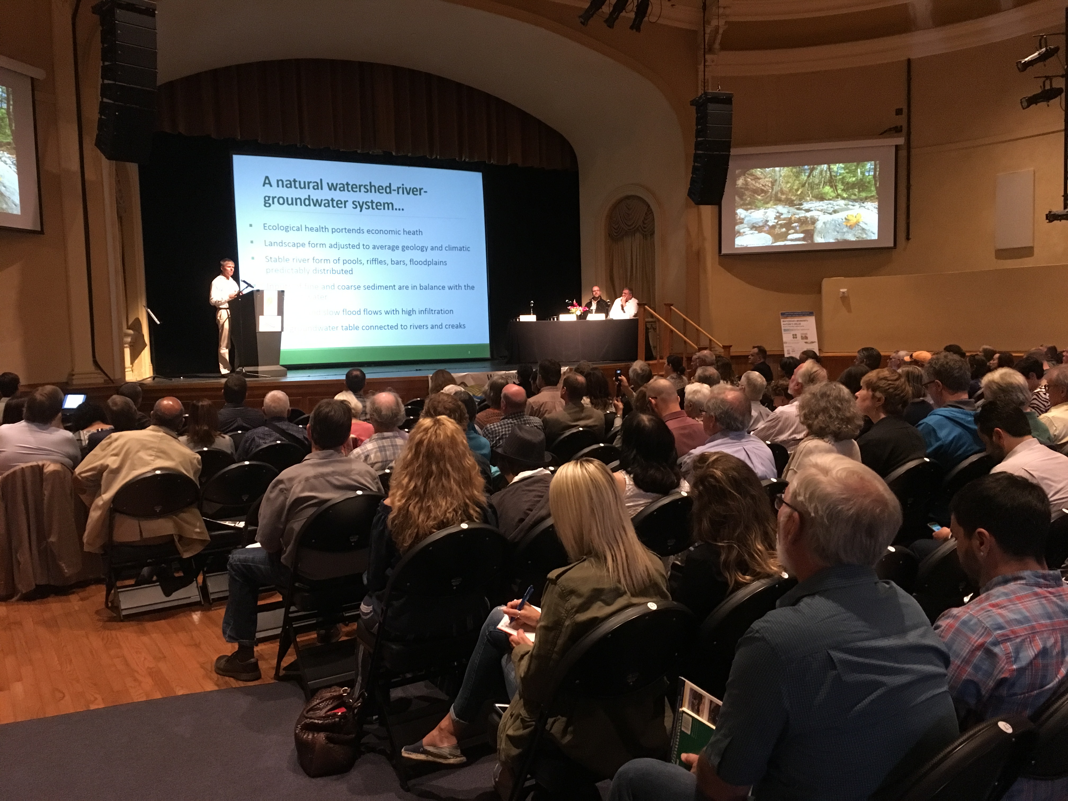
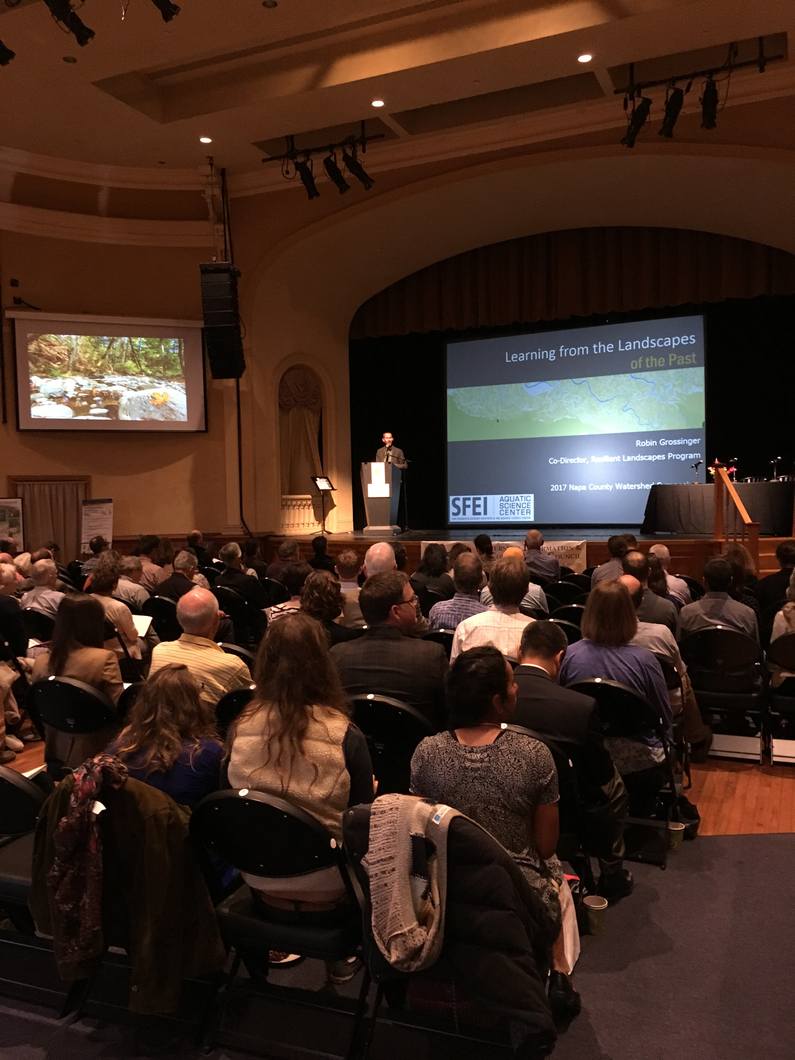
Robin Grossinger, San Francisco Estuary Institute
Are you working with RCD and FONR in Napa Valley and/or are they using the Re-Oaking studies in their re-oaking projects in Napa?
"Now that we've completed some more ecological guidance for re-oaking, we're working with the RCD and FONR to develop some new projects to apply that information. We're excited about the potential to keep growing the re-oaking effort together in Napa!"
What have you learned about best ways to inspire the use of historical ecology in planning in urban and agricultural areas?
"Once we've developed the information, I find it's pretty compelling and speaks well for itself. But to really catalyze new, creative management approaches that take into account the insights of historical ecology, what's most effective is collaborating with local managers and experts to develop visions and plans for the future landscape.
These incorporate both past and present information and future projections to guide the design of more resilient landscapes for both people and nature. This kind of process has been happening in the Delta and SF Bay. Re-oaking is a good focused example in Napa."
How does deforestation impact the Napa River?
From the WICC: This question is too complex to sum up in a few sentences, but to read more on the topic visit The Wild Trout Trust for a summation of how trees impact rivers.
What are the incentives for our agriculture and Board of Supervisors to re-oak our valley and to stop deforesting the hillside?
From the WICC: Sustainable vineyard practices incorporate biodiversity to help minimize insect pests and disease. Oak woodlands are the most diverse ecosystems in California, and when in proximity to vineyards, provide habitat for predatory species that help manage pest populations such as deer, rabbits, gophers, and starlings. Cutting down oak trees on the edge of vineyards can increase the chances of Armillaria root rot infecting the vineyards, and may recruit recolonizing species that host Peirce Disease. Sustainable vineyard practices are being promoted by the Napa County Farm Bureau, Napa Valley Grapegrowers, Napa Valley Vintners, Napa Green Certified Land Program, Napa County Resource Conservation District and others that seek to restore, protect and enhance the watershed, as well as through various river and stream restoration efforts (e.g. - Napa River Rutherford Reach Restoration Project and Oakville to Oak Knoll Restoration Project). For other benefits of re-oaking view the Napa County Voluntary Oak Woodland Management Plan.
Scores of several-hundred-year-old eucalyptus are being clear cut between Napa and Yountville and along the new Vine Trail. What are the replanting strategies specifically along this area and in other places where eucalyptus are part of the California landscape - What grand trees will replace them?
From the WICC: Eucalyptus trees are not native and unfortunately some older trees have become a safety hazard along our roadways. The Vine Trail includes replanting as a part of their planning efforts. There may be areas that would be good sites for the ReOaking the Valley effort.
Napa County has guidelines for replacing oaks that are removed for agriculture use (2:1), but the replaced/replanting are often outside the original watershed. What suggestions do you have to protect our watersheds through replanting?
From the WICC: The County’s policy and practice is tree replacement on-site or nearby whenever possible. Only on rare occasion is tree replacement mitigation done elsewhere.
If oaks are a foundation species of the Napa Valley why do we allow deforestation (14,000 trees at Walt Ranch)? Can re-oaking ever catch up to such destruction?
From the WICC: The Napa County Voluntary Oak Woodland Management Plan provides a good summary of the value of Napa County's oak woodlands. The Plan further offers conservation priorities, suggests sustainable/best management practices and provides recommendations for future actions.
Thomas Harter, UC Davis [pending speaker responses]
Can you please discuss groundwater effects of oak woodlands versus vineyards?
"The effects that the natural landscape, including oak woodlands, has on groundwater will depend on many factors – soils, slope, vegetation density, type of vegetation, whether or not the land is irrigated and at what rate it is irrigated. I am not aware of any studies that have compared the interaction between oak woodland and groundwater versus vineyards and groundwater, in comparable locations. A recent study (Miller et al., Water Resources Research, 2010) of blue oak trees in a California oak-savannah near Ione, CA, may provide some insights into water use and the ability of blue oaks (Quercus douglasii). Measured annual ET (total from grassland and trees) varied from about 12 to 18 inches per year. The study also showed that each summer, much of the ET – about 2 – 3 inches per year – came from a 30 ft deep water table. Williams (Am. J. Enol. Vitic., 2014) reported ET from an irrigated Napa Valley vineyard with 7 foot vine spacing to range from 14 inches to 20 inches, depending on climate and irrigation conditions."
Local control of groundwater clearly did not work in many areas - why? Why will it work going forward?
"The Sustainable Groundwater Management Act of 2014, for the first time in California history, provides a regulatory framework that requires local agencies to plan and implement a sustainable future for groundwater resources. Similar requirements have not been in place before 2014, although courts have performed groundwater adjudications for many decades in groundwater basins where water users went to court. If local agencies fail to sustainably manage their groundwater basin, SGMA provides authority to the State Water Resources Control Board to step in to monitor and regulate groundwater extractions, charge user fees, and work with local agencies to get them back on track"
Who/what is Napa County's GSA (Groundwater Sustainability Agency)?
From the WICC: Consistent with the Sustainable Groundwater Management Act, Napa County submitted the report “Napa Valley Groundwater Sustainability, A Basin Analysis Report for the Napa Valley Subbasin” (a SGMA alternative to a Groundwater Sustainability Plan) that demonstrates the basin has operated within its sustainable yield for a period of more than 10 years. A GSA is not required where it is demonstrated to DWR that the basin is being managed sustainably, as defined by SGMA.
At the symposium, Belia Ramos (supervisor), mentioned that Napa County is 'ahead of the game' in regards to groundwater management. Napa County only contains valley floor basin. What about the groundwater in the Carneros and hills? What is the interaction between these basins?
From the WICC: The Sustainable Groundwater Management Act (SGMA) requires that Groundwater Sustainability Plans (GSPs) or their equivalent alternatives to a GSP be developed for medium and high priority groundwater basins as delineated and ranked by the State Department of Water Resources (DWR). The hillsides do not fall within the Napa Valley Subbasin that the Basin Analysis Report addresses. Because the hillsides do not act as a basin, but instead as thousands of discrete subareas based on local geography, it is not scientifically or economically practical to “study the hillsides”. However, the hillsides are included in the Napa Valley Subbasin water budget by incorporating uplands runoff and subsurface inflow.
The Carneros Subarea is not a DWR-defined basins, but it is a subarea that Napa County has established based on watershed boundaries and the County’s environmental resource planning areas for the purposes of local planning, understanding, and studies. The Carneros Subarea partly overlaps with the Napa- Sonoma Lowlands Subbasin which is a DWR-designated very low priority Subbasin for which a GSP or Alternative is not required. Updates on groundwater conditions in the Carneros Subarea have been and will continue to be included in the County’s Annual Groundwater Monitoring Reports.
What percentage of all Napa Valley groundwater is attributable to watershed basis, such as the MST (Milliken-Sarco-Tulocay)?
From the WICC: Subsurface inflow to Napa Valley, and the Napa Valley Groundwater Subbasin, from the upslope bedrock watersheds is likely minor relative to the volume of recharge generated by precipitation that falls across the Subbasin and runoff to the Subbasin from the uplands. Geologic formations surrounding the Subbasin consist of predominantly low permeability volcanic and sedimentary rocks. Data relating to subsurface inflow to the Subbasin from surrounding bedrock is limited to the studies conducted in the Milliken-Sarco-Tulucay (MST) area. A U.S. Geological Survey (USGS) study by Johnson (1977) estimated that subsurface outflow from the MST into Napa Valley was roughly 2,050 acre-feet per year (AFY). A more recent USGS study by Farrar and Metzger (2003) estimated outflows of 600 AFY from the MST into Napa Valley. The water budget analysis included in the Basin Analysis Report for the Napa Valley Groundwater Subbasin used watershed scale modeling and geologic maps to estimate subsurface inflow into the entire Subbasin, not just from the MST. That analysis found that subsurface inflow to the Subbasin averaged 7% of the amount entering the Subbasin from recharge due to precipitation across the Subbasin from 1988 to 2015.
Although designated as a groundwater subarea for local planning purposes, the majority of the MST is not part of a groundwater basin as mapped by the California Department of Water Resources (DWR). Depths to groundwater in the MST Subarea currently range from about 60 feet in some areas to 200 feet or greater in other areas. Groundwater level declines observed in the MST Subarea as early as the 1960s and 1970s have stabilized since about 2009. The MST Subarea has been designated as a water deficient area by Napa County. As a result, County requirements for permitting certain proposed development projects that include the use of groundwater are more stringent than in other parts of the county.
Why has the state chosen not to consider this contribution to our groundwater resources (no studies, monitoring, etc.)?
From the WICC: The Sustainable Groundwater Management Act requires that Groundwater Sustainability Plans (GSPs) or their equivalent Alternatives be developed for medium and high priority groundwater basins as delineated and ranked by the State Department of Water Resources (DWR). The MST Subarea is not a DWR-defined basin, but it is a subarea that Napa County has established based on watershed boundaries and the County’s environmental resource planning areas for the purposes of local planning, understanding, and studies. With regards to the MST, it is one of the most monitored areas of the county, with data dating back many decades. There are significant land use controls in place in the area (the county has not approved a discretionary project in the MST that couldn’t meet the “no net increase” standard since 2004), and significant effort has gone into constructing a recycled water pipeline to the area, that became operational in 2016.
Underlying the MST, the Sonoma Volcanics generally provide small amounts of water to wells.The tuffaceous member of the Sonoma Volcanics is a more important source of groundwater compared to the Sonoma Volcanics that consist of andesitic and basaltic lavas.
Is there any practical difference between managing deep groundwater (where the wells are) and shallow groundwater (that provides base flow)?
"There can be practical differences where physical barriers within a basin impede the flow of groundwater vertically, such as through low permeability geologic materials, or where groundwater quality varies significantly between shallow and deeper parts of a basin. For example, pumping in a deep aquifer that is separated from the shallow aquifer by a continuous, low permeable clay layer will still impact the shallower aquifer. But the clay layer would significantly delay and dampen the response of the shallow water table to seasonal variations in deep aquifer pumping (and recharge)."
How do we know about sustainability outside of the main basin?
"See response below related to sustainability"
How do we really know we are sustainable?
"In the context of the SGMA, assessing sustainability requires using the best available data to evaluate how a groundwater basin responds to changing conditions over time, whether due to human actions or not, and to consider how changing groundwater conditions impact beneficial uses and users of groundwater in the basin, including groundwater dependent ecosystems. In Napa County, and especially Napa Valley, there is a good foundation of available data (including groundwater monitoring), relative to other groundwater basins in the state. Over many decades, the County, the Flood Control and Water Conservation District, and cities and towns within Napa Valley have worked to ensure that supplies of both surface water and groundwater are managed well, guided by the best available data. Going forward, the Sustainable Groundwater Management Act requires long-term commitments on the part of local agencies to improve the understanding of conditions and respond accordingly with management decisions."
Why has the State not included the smaller fractured basin areas in Napa County in the SGMA regulation?
"The decision to exclude fractured rock areas from the Sustainable Groundwater Management Act (SGMA) and subsequent regulations is not unique to Napa County. For historical reasons, the Department of Water Resources (DWR) has been mostly focused on alluvial basins, because, alluvial basins store and supply much more water at the regional scale across the state. DWR’s past groundwater assessments (“Bulletin 118”) therefore only delineated these alluvial basins. SGMA uses DWR’s aquifer delineations and therefore applies only to alluvial groundwater basins Locally, fractured rock aquifers can serve as significant sources of water, and SGMA does not preclude local agencies from using their authorities to ensure the sustainability of groundwater resources in those areas too. DWR may choose at some future point to also delineate some fractured groundwater basins."
What impact does drain tiles have on groundwater: positive or negative?
"Drain tiles are systems that may be installed below the land surface to facilitate drainage of water from land surface to a depth of several feet below the land surface, often to protect crop roots from excess moisture accumulation. Depending on conditions at a given site, drain tiles may enhance the rate of drainage of water from the land surface to a depth below the root zone or prevent groundwater levels from rising into the rootzone from below. By design, drain tiles affect the percolation and accumulation of water in the shallow subsurface at or near the rootzone; however, such systems are only one of many ways in which people can influence the hydrologic cycle at the field scale. As to whether their impact is positive or negative at the scale of a groundwater basin, that would depend on the many factors including the distribution of drain tiles systems and the way in which they are operated. Napa County is currently developing a project to learn more about the drain tile systems in Napa Valley in order to better understand how they influence hydrology at the basin scale across Napa Valley, including any influence on streamflows."
Do we have information on all the existing wells total gallons of pumping? How can we publish the amount of saving with no information before?
From the WICC: Napa County has a groundwater monitoring program and provides annual monitoring reports. See the WICC groundwater webpage or the Napa County groundwater webpage for additional information.
Jonathan Koehler, RCD Senior Biologist
Which streams are suffering incision and detrimental effects of point sourcing of runoff? Which streams need the most help and efforts to manage these problems?
"The entire mainstem Napa River has incised and is now deeper relative to its floodplain (more entrenched) than it would have been historically. Nearly all of the valley floor reaches of the tributaries have also incised in response to the lower river elevation. This incision is believed to have been caused primarily by channel simplification (converting multi-thread streams into single-thread streams), construction of levees and berms along the tops of the streambanks, and a reduction in coarse sediment supply due to reservoir and pond construction. I am not aware of any efforts to rank the relative incision levels of Napa’s streams, so I can’t list which tribs are best and which are worst in regards to incision. That said, RCD and others have conducted extensive field mapping of stream conditions and have a general sense of which stream reaches are incised and which ones are not."
Dan Logan, NOAA's National Marine Fisheries Service
Can speakers talk about the relationships between large-scale water transfer statewide (from the Sierra Nevada watershed into metropolitan areas) and statewide ecological health? What's the relationship between water movement and ecology?
Answer: From Garwin Yip, the Water Operations and Delta Consultations Branch Chief for NMFS’s Central Valley office via Dan Logan.
"The National Marine Fisheries Service’s 2014 California Central Valley Salmon & Steelhead Recovery Plan, and specifically the executive summary, provides a brief overview of the historical context associated with the decline in Central Valley salmonid species and degradation of their habitats. In particular, as it pertains to water movement and ecology associated with large-scale water transfers statewide, “Although the effects of habitat degradation on fish populations were evident by the 1930s, rates of decline for most anadromous fish species increased following construction of major water project facilities (USFWS 2001), which primarily occurred around the mid- 1900s. Many of these water development projects completely blocked the upstream migration of Chinook salmon and steelhead to spawning and rearing habitats, and altered flow and water temperature regimes downstream from terminal dams. As urban and agricultural development of the Central Valley continued, numerous other stressors to anadromous salmonids emerged and continue to affect the viability of these fish today. Some of the more important stressors include: the high demand for limited water supply resulting in reduced instream flows, increased water temperatures, and highly altered hydrology in the Sacramento-San Joaquin Delta, barriers to historic habitat, widespread loss of tidal marsh, riparian and floodplain habitat, poor water quality, commercial and/or recreational harvest, and predation from introduced species such as striped bass.”
Lester McKee, San Francisco Estuary Institute
Is rainfall in an area considered when Planning Departments approve increase of development and housing? Do we send the water from the Feather river to Los Angeles?
"Rainfall alone is not as important as how rainfall interacts with geology and slope. Building departments do take into account landslide potential and other rainfall related hazards such as flood potential and groundwater levels when considering building permits especially on slopes >5% which are more prone to earth movement or in river floodplains when the ground water levels can be near the surface. You would need to talk with your building and planning departments at the local city and county agencies to see what development policies are in place in relation to rainfall related hazards. Development on marginal lands does lead to a greater chance of environmental impacts such as additional sediment production and those challenges can be greater in higher rainfall areas but landscape context is as, if not more, important.
Low impact development (LID) (things like bioretention (rain gardens), green roofs and walls, bioswales, and pervious pavements) is seen as a solution in relation to new and redevelopment for mitigating the effects of impervious surfaces (roofs, driveways, parking lots and roads). LID is designed to slow, spread, and sink (or capture and filter) about 80% of the annual rainfall. Designed appropriately, this can be good news for reducing peak flows and the volume of runoff, increasing slope stability, and reducing sediment erosion in creeks downstream from a new or redevelopment site. Applied in many places, this can add up to more groundwater for irrigation, drinking water, and cool base flow water for fish. Since these are all important issues that Napa residents are trying to deal with, LID should be included as one of the tools in the tool box."
From the WICC: Yes. Many planning departments address impacts from rainfall and runoff through development lot coverage limitations and impervious surface limits. These standards are most often administered through municipal stromwater programs and zoning codes. The CA Department of Water Resources (DWR), via the State Water Project, transfers water from the Feather River to the City of Los Angeles.
What is the impact of the loss of sediments trapped in the municipal reservoirs? What solutions do you see?
"Continue to work on removing dams tha are no longer needed or able to function for the original intended use. Continue to work on removing other fish barriers to promote coarse sediment transport and improve habitat access. Continue to work on increasing creek width so that the coarse sediment that is there can be organised by the river or creek into pockets of differing grain sizes. Where appropriate route coarse sediment around reservoirs using pipes and trucks to place it in a downstream area that has enough energy to transport and sort it into pockets of sands and gravels that make good habitat."
From Mike Napolitano, San Francisco Bay Regional Water Quality Control Board: I think the options below would be winners in terms of potential benefits to private/public landowners, channel habitat conditions, and bedload sediment supply to Napa River tributaries, the Napa River, and Napa-Sonoma Baylands.
1. One untapped source might be the large number of small on-channel reservoirs (a few hundred or more) that drain directly into the channel network, and which are not nested upstream of municipal reservoirs. In the Carneros Region, for example there are a lot of these reservoirs experiencing very high rates of deposition, where the water storage capacity and/or lifetime of the reservoir may be substantially reduced in the near future absent, thinking ahead about how the reservoirs might be dredged and how some of the sediment removed might be injected downstream to beneficially increase bedload supply.
The other exciting side-benefit of thinking about this set of problems, would be the opportunity to monitor sediment fluxes to these locations, and how these vary in response to terrane type, land use, and the timing of wet years and large storms.
2. The other major largely untapped bedload source would be the Sulphur Creek fan, which appears very much in-need of management attention to avoid heightened flood risk in parts of the Town of St. Helena, and which easily contributes more than 10 percent of the total bedload supply to the Napa River. Perhaps it might be possible to explore channel sediment routing options through beneficial enhancements to channel habitat and sediment transport capacity that could help to keep sediment deposition in the fan in balance with erosion (transport through).
3. There also are many lower tributary reaches that were naturally disconnected and historically ditched, where culverts, sharp bends at property lines, and/or other constrictions are contributing to significant local flooding problems and/or property damage. Two examples include lower Bear Canyon Creek and lower York Creek, both of which have high unit rates of bedload supply.
From the WICC: The Napa River Sediment TMDL and Habitat Enhancement Plan provides a discussion and information on what is known about sediment transport in the Napa River watershed.
Mr. McKee is key author of the article "Comparison of sediment supply to San Francisco Bay from watersheds draining the Bay Area and the Central Valley of California" featured in the journal Marine Geology. The article discusses sediment contributions of various watersheds draining to the San Francisco Bay.
The Napa River Watershed Profile: Past and Present Characteristics with Implications for Future Management of the Changing Napa River Valley (San Francisco Estuary Institute, 2012) provides a watershed-based framework for addressing local challenges related to improving the health of the Napa River ecosystem. The report identifies possible adaptive management measures whose implementation could allow the State Water Board to declare the Napa River unimpaired under section 303(d) of the US Clean Water Act.
As far as sediment load and percentage of sources - what year did that data come from? If older data, would programs such as Napa Green river restoration project & County Conservation Regulations change those percentages?
"I have to acknowledge that the data are getting old (10+ years and longer) and the data on sediment loads at the USGS gauge near Napa are from the 1970s. More sediment data are needed to check on the validity of the old rating curves and there needs to be a revised effort to collect information on coarse sediment bed load transport which is largely lacking for the Napa River.
Any efforts to address data weaknesses will lead to better planning and restoration decisions. Data collection and planning processes usually take years but usually cost a fraction of the cost of restoration efforts that follow. So spending the time (if we have it) to adapt our planning and management decisions and tools as new data comes to fruition is usually seen as a cost effective approach.
One data gap that is obvious to me is determining which management and restoration options will be most cost effective. I am not sure what metrics should be used but you could consider $/fish (either return to spawn or young of the year). Do we know if reducing fine sediment supply is more cost effective than giving the river width to allow sediment to sort into pockets? Or is removing barriers and opening up more habitat more cost effective?
Along with these questions are the questions of performance and opportunity. Are there many or just a few places where the most cost effective management or restoration measures can be implemented and will those few places be enough to get us to our goals for the watershed? Will the performance of those management measures in those places be sustained over time or will ongoing maintenance be needed to maintain performance? We usually expect that restoration and management measures that are self sustaining end up being most cost effective over the longer term."
Lisa Micheli, Pepperwood Preserve
Do you feel that reversal of climate change will happen?
"The amount of greenhouse gas emissions that we have already put in the earth’s atmosphere has put us on a warming trend that will last at least a century, so while reversal is possible, not necessarily in our lifetimes. However, within our lifetimes we have an absolutely critical opportunity to turn around the current pattern of growing emissions so that we can slow, and yes perhaps eventually reverse this process. In other words, our goal now should be to keep the warming to a minimum and avoid the “worst case scenarios” which are based on continuing our current path and rate of increasing emissions. Reducing emissions, or trying to “reverse” the current pattern, is what we call climate change “mitigation."
Do you feel that scientists and citizens' efforts are best spent on reversal or adaptation efforts?
"We are not in an “either/or” situation. We need to mitigate our emissions to avoid worsening the situation and we need to understand how to adapt to the changes already underway. In the case of Sonoma County, we are prioritizing actions, like water conservation and open space protection, that simultaneously advance both mitigation and adaptation objectives."
What can regular citizens really do to effect change in our climate?
"Citizens can take action in both the private and public realms. There are many tools out there to calculate your personal or small business carbon footprint (such as http://www.carbonfootprint.com) that empower you to understand what choices you can make as a consumer to reduce your personal impact, including how to reduce your personal dependence on fossil fuels and switch to renewable energy, such as solar. In the public realm, it is important for citizens to research the policy issues and to promote and vote for political candidates and policies that will move us into a greener economy at the local, state, national, and global levels."
Michelle Selmon, CA Department of Water Resources
What is California doing with the $97 billion vote for increasing water storage without damming rivers?
"Prop 1 authorized $2.7 billion [not $97 billion] out of the $7.5 billion water bond for water storage projects. The California Water Commission (CWC) will determine which projects will be funded through its competitive grant program - the Water Storage Investment Program - and those projects will support the California Water Action Plan. This money can only be used for funding “public benefits” resulting from storage projects (i.e. ecosystem improvements, water quality improvements, flood control benefits, emergency response, and recreational purposes), and at least half of those benefits must be for improving ecosystem conditions. The CWC is considering a number of projects that entail new or enhanced on-stream and off-stream reservoirs. Other Prop 1 funds that have or will be allocated to state agencies to distribute will be used for ecosystem and watershed protection and restoration, and groundwater storage, which will also increase storage and resilience in the future."
How concerned are you and your colleagues that Donald Trump's climate change and science denialism will take California in reverse on adapting to and planning for climate change?
"Take heart! Despite the lack of federal leadership we can expect over the next few years, California is continuing to be a leader nationally and globally with our efforts to mitigate (reduce future impacts) and adapt (prepare for inevitable changes) to climate change. This New York Times article nicely sums up the momentum and trajectory of climate action in California. The California Department of Water Resources will continue to be a leader at the state level."
Climate science informs us that we're on the threshold of irreversible climate tipping points. What automatic triggering formula can be used that would trigger changes in land use policy to guard against further loss of forest climate services?
"Wise land use decisions will certainly be an important factor to ensure future climate change resilience, within forested areas and also densely populated urban regions. The good news is that land managers recognize this and most planning activities these days, including general plans for cities and counties, forest management plans, local and state hazard mitigation plans, etc. all must consider climate change and include appropriate strategies to deal with it. With regard to forest management specifically, we need to direct more funding to best management practices that include forest thinning and meadow restoration. In addition to retaining more water in high elevation regions, these actions will decrease the risk of catastrophic wildfire and pine bark beetle infestation, both of which have contributed to the 100 million dead trees we currently have in the Sierra Nevada."
From the WICC: Dr. Lisa Micheli and Michelle Selmon both discussed climate change and how to plan for the future. Several questions were asked if the reversal of climate change is possible and how citizens can help.The California Landscape Conservation Cooperative Climate Commons is a great starting point for discovery of climate change data and related resources, including information about the science that produced it, and guidance for applying climate change science to conservation in California, as well as in Napa County.
Would intensified helicopter use, noise and disruption affect local birds, fish, wildlife and ecosystems?
From the WICC: It can affect these but their use would typically require permits from the city or county and be subject to locals plans/regulations including CEQA review/EIRs as well as FAA regulations.
Is there legislation that should look at volcanism?
From the WICC: Volcanism is any various processes and phenomena associated with the surficial discharge of molten rock, pyroclastic fragments, or hot water and steam, including volcanoes, geysers, and fumaroles. The Journal of Volcanology and Geothermal Research is a good source to find the latest research on the topic.