
Groundwater Monitoring Wells: A ‘Picture’ of Underground Water Connections for Groundwater Sustainability Plans
Dec 2, 2019 at 10:00am
During the months of October and November, up to 21 groundwater monitoring wells will be drilled near Sonoma County creeks to provide new information to managers and the public on the link between groundwater and stream flows. Coordination and construction of the wells are a technical service provided by the California Department of Water Resources (DWR) to Sonoma County’s three Groundwater Sustainability Agencies (GSAs).
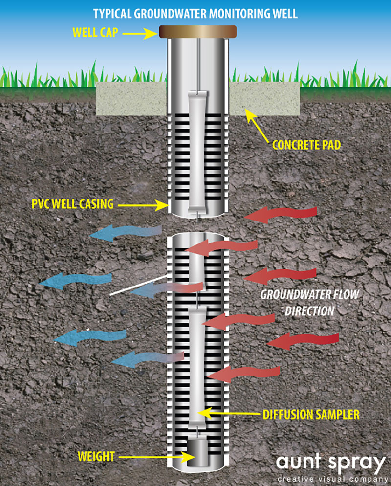
Each well will be about 50 feet deep, and will be designed specifically for measuring water levels throughout the year. These measurements, when paired with information about the water flowing in nearby streams, help paint a picture of the link between groundwater aquifers and the surface water in creeks, streams and rivers.
“We can’t see what’s beneath the surface, so these monitoring wells act like underground telescopes. They can help us see how much and when water is available,” said Sonoma County Supervisor Susan Gorin, who serves as the chair of the Sonoma Valley GSA.
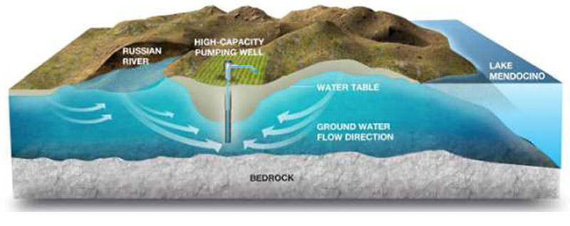
The connection between groundwater and surface water is an important component of the Groundwater Sustainability Plans (GSA) are being prepared by Petaluma Valley, Santa Rosa Plain and Sonoma Valley GSAs. The state-required plans must determine if groundwater pumping is resulting in the loss of water in streams that support endangered and threatened fish and other species.
“These wells will help us better understand the link between specific streams and aquifers so we can make informed decisions about how to protect fish, other wildlife and plants during future droughts and in our changing climate,” said Sonoma County Supervisor Lynda Hopkins, who is Chair of the Santa Rosa Plain GSA.
Continue reading full original article.