Groundwater Basics
Groundwater is water located below ground where the voids or pore spaces between sediment grains or rocks are fully saturated. Groundwater originates from a variety of sources, including precipitation, irrigation, infiltration from surface waters, and injection wells to name a few. Groundwater can flow from one part of the subsurface to another; it can also leave the subsurface as outflow to streams or other surface waters, spring flow, evaporation, and discharges from wells. In a sense, all groundwater starts as some form of surface water. The two types of water, surface water and groundwater, are inherently connected.
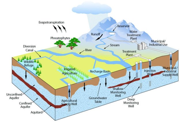
Groundwater is part of the water cycle
Depending on location, slope, geology, soil type and vegetation, the ground can receive and retain groundwater similar to the way a sponge soaks up water. The percolation process that moves water from the surface to the subsurface is often a relatively slow process that occurs over several years to over a millennium in some cases.
Groundwater is a vital source of water supply in Napa County. Many residents, businesses and agriculturists rely on groundwater, as do fish, wildlife and natural habitats. Because of this great dependence on groundwater, it is essential to:
- Preserve the quality and availability of all local and imported water supplies
- Sustain groundwater supplies to meet future needs and availability during drought conditions
- Anticipate and avoid potential environmental effects due to the overuse of groundwater
- Anticipate and take steps to avoid potential losses in long-term groundwater availability and quality.
Everyone living and working in Napa County has a stake in protecting the County's groundwater resources. Without sustainable groundwater resources, the character of the County would be significantly different in terms of its economy, communities, and ecology.
To address these challenges, long-term, systematic monitoring is essential to provide data allowing for improved evaluations of water resource conditions and trends. Napa County has embarked on a countywide Groundwater Monitoring Program to develop a sound understanding of groundwater conditions through groundwater monitoring and data management. The program provides a foundation for coordinated, integrated water resources planning and dissemination of key water resources information.
Because groundwater availability can vary within larger groundwater basins, and since groundwater use occurs both within and outside of established groundwater basins, the Napa County Groundwater Monitoring Program has delineated the entire county into 17 subareas based on geographic, geologic, and political boundaries. These groundwater subareas provide a basis for the presentation of data both on this website and in related reports.
Napa Valley Subbasin Groundwater Sustainability Agency
The 2014 Sustainable Groundwater Management Act (SGMA) provides a framework for sustainable management of groundwater resources by local authorities. Napa Valley Subbasin is categorized by the Department of Water Resources (DWR) as 1 of 46 high priority groundwater basins statewide. The Groundwater Sustainability Agency (GSA) was created on December 17, 2019 by the Napa County Board of Supervisors to prepare the Groundwater Sustainability Plan (GSP), a 20-year plan to ensure that groundwater is managed sustainably within the basin. The GSP will contain 12 sections in total. Draft sections will be released on a monthly to quarterly basis through September 2021. Meetings for the GSA and GSPAC are held monthly and are open to the public.
Napa County and other public agencies have been monitoring and studying groundwater resources since the mid-1900s. This work has improved our understanding of groundwater conditions. Based on these efforts, the County has been able to:
- Expand voluntary groundwater monitoring in key locations to provide better data and fill data gaps
- Develop better groundwater data collection procedures
- Report on annual groundwater trends and conditions
- Estimate the rates of aquifer replenishment and study groundwater and surface water interaction
Groundwater data availability in Napa County varies widely among the subareas. The bulk of the historical and current groundwater level and quality data is located in the Napa Valley area with limited data elsewhere.
Groundwater level trends in most of the Napa Valley floor appear to be stable for the majority of wells monitored. While many wells have shown at least some degree of response to recent drought conditions, levels do recover in the spring after winter rains. Elsewhere in the County long-term groundwater level records are limited, with the exception of the MST Subarea. Groundwater level declines observed in the MST as early as the 1960s and 1970s have stabilized since 2009.
Infiltration of precipitation has been shown to provide significant groundwater recharge in Napa County, particularly in unconsolidated geologic settings like much of the Napa Valley floor (Kunkel and Upson 1960, LSCE and MBK 2013). Recently, long term precipitation records in Napa County have been used to develop a water year rating system that defines Very Dry, Dry, Normal, Wet, and Very Wet water year types (LSCE 2016, 2NDNATURE 2013).
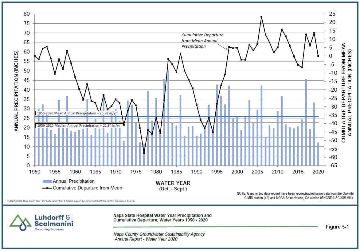
Napa State Hospital Annual Precipitation - Click image to view larger
Since the mid-1900s consecutive Dry or Very Dry years have occurred five times. Groundwater levels have shown greater sensitivity to shorter periods of well below-average precipitation, such as the consecutive Very Dry years of 1976 and 1977. Many monitored wells recorded their lowest groundwater levels in 1977, although the subsequent period from 1987 to 1994 saw a long period of below-average precipitation. Nevertheless, for those areas of the county where groundwater data are available, groundwater levels typically recover to previous levels with the return of average rainfall, despite experiencing some decline during times of drought.
Napa County Groundwater Monitoring Plan
Groundwater and surface water are highly important natural resources in Napa County. The Napa County Groundwater Monitoring Plan was put in place in order to address groundwater-related challenges within the County. The Napa County Groundwater Monitoring Plan is a living document that will be updated based upon the data collected. Its purpose is to formalize and augment current groundwater monitoring efforts (levels and quality) to better understand the groundwater resources of Napa County. The plan will aid in making the County eligible for public funds administered by the California Department of Water Resources (DWR), and will regularly evaluate trends to identify changes in levels and/or quality and factors related to those changes that warrant further examination to ensure sustainable water resources.
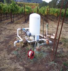
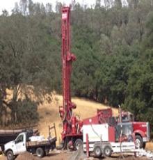
Over the past several years, Napa County has developed a more focused understanding of the geology that controls the occurrence and availability of groundwater. With this updated geologic information and with assistance from community members serving on the Groundwater Resources Advisory Committee (GRAC 2009-2011), the County expanded the number and distribution of wells that it monitors to improve the understanding of groundwater resources countywide. Between 2011 and 2015 the number of County monitored wells increased from 47 to nearly 100. Part of the monitoring network expansion in recent years occurred through the construction of 10 dedicated monitoring wells at 5 sites in Napa Valley, designed specifically to provide data on the interactions between groundwater and surface water. In total, 107 wells were monitored in 2020.
Voluntary Groundwater Monitoring
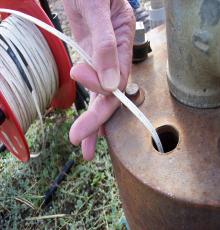
The Voluntary Groundwater Level Monitoring Program measures groundwater elevation twice per year (Spring and Fall). These measurements improve the understanding of groundwater for the landowner and the County. A comprehensive network of privately owned volunteer wells, along with publicly owned wells, provides a greater understanding of Napa County aquifers. The program will be strengthened by expanding the voluntary well network to areas where data is lacking or nonexistent.
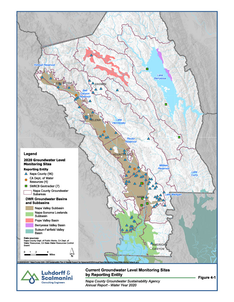
2020 Groundwater Level Monitoring Sites
Click image to view larger
Community Science - Stream Watch
Stream Watch is a Community Science program designed to help us find out when our waterways start and stop flowing. This information will be compiled over several years to learn more about our creeks and the habitats they provide, so we can take better care of them now and as our climate changes. Learn more by exploring our interactive Storymap.
Groundwater Sustainability Agency
The 2014 Sustainable Groundwater Management Act (SGMA) provides a framework for sustainable management of groundwater resources by local authorities. The act establishes a timeline - 20 years - to implement actions that achieve long-term groundwater sustainability. It protects existing surface water and groundwater rights and does not impact drought response measures. The Department of Water Resources (DWR) is in charge of the SGMA Program and has developed guidelines for local agencies to follow.
On December 17, 2019, the Napa County Board of Supervisors conducted a public hearing under Water Code section 10723 and adopted a resolution affirming Napa County's intention to manage groundwater in the Napa Valley Subbasin and to form the Napa County Groundwater Sustainability Agency (GSA) pursuant to Water Code section 10724, and authorized the submittal of GSA Formation Information to DWR. Water Code section 10724 provides that the County is presumed to be the GSA for the areas in the Subbasin that are "unmanaged" (not within the management of GSA). DWR's SGMA website portal provides local agencies, GSA's, and watermasters the ability to submit, modify, and view the information required by SGMA, and enables the public and interested stakeholders to view submitted information and provide comments, where applicable. No login is required for public access.
On January 7, 2020, the Napa County GSA held its first meeting. The agenda for this first meeting was to elect officers, appoint an executive officer, adopt a 2020 meeting calendar, and approve a resolution authorizing the submittal of a $2.6 million dollar grant application to DWR to support the development of a Groundwater Sustainability Plan (GSP) for the Napa Valley Subbasin. The new GSA is required to develop a GSP for the Napa Valley Subbasin and submit it to DWR by January 2022.
On February 6, 2020, the Napa County GSA submitted notification to the Department of Water Resources of their intent to prepare a Groundwater Sustainability Plan for the Napa Valley Subbasin.
The Napa County GSA meets monthly. Additional details on the upcoming GSA meeting can be found on the GSA's Governance & Meetings webpage.
Sign up to be on the Napa County GSA email list to learn about opportunities to participate. Please encourage others who are interested in groundwater to also join the GSA email list by providing them with this sign-up link: http://eepurl.com/bWgdin.
To learn more about groundwater monitoring occurring in Napa County visit the Groundwater Trends and Conditions page. On this page you can read a brief summary of current monitoring results and trends. You can also use the interactive maps to get more details about groundwater in various parts of Napa County.