Napa Valley Historical Ecology Atlas
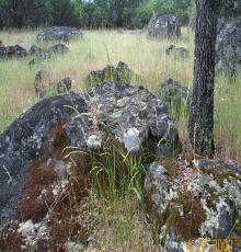
The Napa Valley Historical Ecology Atlas will be a highly visual exploration of the native Napa landscape and its physical transformation over the past two centuries. Using rarely seen historical maps, photographs, and paintings, the Atlas will investigate this remarkable landscape and its contemporary remnants, establishing a new perspective on the iconic region we know today.
The Atlas is based upon the innovative "forensic" landscape research of the San Francisco Estuary Institute – collaborating locally with the Friends of Napa River – which uses hundreds of independent pieces of evidence to reconstruct the patterns of rivers, wetlands, and woodlands at the time of European contact. The Atlas will provide a range of information to inform ecological restoration efforts currently taking place in the region. It will also provide one of the few publicly accessible illustrations of a detailed historical landscape reconstruction, focusing on one of the most popular regions in the world.
The goal of the Atlas is to make landscape change -- the largely invisible history of local places -- visible to general audiences. The book will be written and designed using San Francisco Estuary Institute's (SFEI) accessible style to present scientific information in a compelling and intriguing way. The combination of repeat photography, comparative maps, and remarkable historical quotes -- all linked to specific geographic sites -- will create a multifaceted view of the hidden layers of history and ecology embedded within the Napa Valley landscape.
To help readers experience this perspective, a driving/walking tour will follow the text, accompanied by a map series with historical sites and habitat overlays. The book will introduce both newcomers and locals to a new view of the Napa Valley while providing a model for the restoration of landscapes throughout California.
The Napa Valley Historical Ecology Atlas is expected to be released by the University of California Press in Spring 2012. For more information, or to be put on the announcement list, please contact robin@sfei.org.
Table of Contents
Acknowledgments
1. Exploring Napa Valley
Geography, Geology, and Climate • A Brief History • A Map of Napa Valley circa 1811
2. Oak savannas and wildflower fields
Mapping the Oak Lands • Scattering Oaks • Savanna Composition • Burning the Valley • A World of Wildflowers • Valley Oaks and People • Oak Trajectories • Re-Oaking the Valley
3. Creeks
Sinking Streams • Alteration of the Drainage Network • The High Water Table Problem • Summer Water • Channel Incision • Braided Channels • Riparian Loss and Recovery
4. Valley wetlands
Freshwater Marsh • Wet Meadows • Vernal Pools • Alkali Meadows • Wetland Mosaics and Fragmentation
5. Napa River
The River Spread into Wetlands • Islands and Sloughs • The Valley in Flood • Has the River Been Straightened? • How Deep Was the River? • Disappearing Gravel Bars • Did the River Flow Year-Round? • Riparian Forest Width • Narrowing of the Riparian Corridor • Beavers and Snags • Jepson's Napa River • Glimpses of the Tidal River Corridor • Fish Assemblages • Patterns of River and Valley • The River Responds
6. Tidal marshland
Kerr's Map • The Tule Lands • Dredging the Tidal River • Reclamation and Restoration • Marsh Chronologies • The Edge
7. Landscape transformation and resilience
The Responsive Landscape • Accommodating Climate Change • Redesigning the Valley
8. Landscape tours
American Canyon, South Napa, Carneros • Napa to Oakville • Yountville to St. Helena • North of St. Helena to Calistoga
Bibliography
Index
Prior publications from the project
Napa Valley register article: August 29, 2010