Our Watersheds
What is a watershed?
Watersheds are more than just drainage areas. They are the places where we live, work, and recreate.
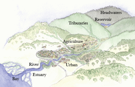
A watershed is an area of land that drains into a common waterway. Ridgetops form the boundaries between watersheds, and the lay of the land determines the direction water flows. Watershed boundaries may cross county, state, and international borders.
Within a large watershed, there are smaller subwatersheds or drainages. For example, within the Napa River watershed, a smaller area of land drains into Redwood Creek. This area of land is the Redwood Creek subwatershed. The Napa River watershed is part of the larger San Pablo Bay Watershed.
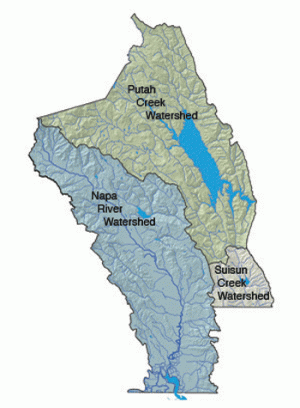
Napa County's three major watersheds
The Napa River Watershed is almost entirely within Napa County (a small portion is also in Solano County). It is defined by Mt. St. Helena to the north, the Mayacamas Mountains to the west, Howell Mountain, Atlas Peak, and Mt. George to the east, and the Napa-Sonoma Marsh to the south. The Napa River runs through the center of the watershed on the valley floor, draining numerous tributaries along a 55 mile run from the headwaters of Mt. St. Helena to the San Pablo Bay. The Napa River winds through many types of landscapes: forested mountain slopes, vineyards, urban areas, open pasture, grasslands, industrial zones, and marshes.
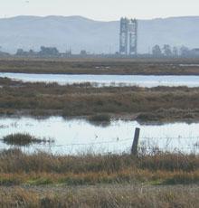
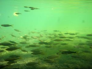
The Napa River Watershed is home to most of the residents and developed areas in the county. It is estimated that 95% or more of the entire population of Napa County live in the Napa River Watershed. Reservoirs in the watershed include Lake Hennessey, Lake Milliken, and Bell Canyon Reservoir. This watershed also provides habitat for many types of plants, fish, and wildlife. Chaparral, brackish and saltwater marsh, vernal pools, forests, oak woodlands, grasslands, and riparian habitats can all be found in the watershed.
Learn more about the Napa River watershed with maps! The links below take you to interactive maps that illustrate different feaures of the watershed.
The Putah Creek Watershed lies in four counties: Napa County, Lake County, Solano County and Yolo County. Putah Creek begins in Lake County, and empties into the Sacramento River.
The watershed is bounded by Howell Mountain and Atlas Peak to the west and the Blue Ridge and Vaca Mountains to the east. The dominant feature in the watershed is Lake Berryessa, formed when Monticello Dam was built on Putah Creek in 1957. Major land uses in the watershed are recreation and rangeland.

The watershed supports a unique assemblage of natural communities including serpentine chaparral, grasslands, oak savanna, oak and mixed oak/coniferous woodlands, riparian, freshwater lake, and cliff habitats.
Learn more about the Putah Creek watershed with a map! The links below take you to interactive maps that illustrate different feaures of the watershed.
The Suisun Creek watershed falls within Solano and Napa Counties. Separated from the Napa Valley by Mt. George in the west and bounded by the Vaca Mountains in the east, the watershed contains the upper reaches of Suisun Creek (which eventually empties into Suisun Marsh and Suisun Bay) and several of its tributaries including Wooden Valley and Gordon Valley Creeks.
Farms, ranches, and vineyards are found in this watershed, along with oak woodlands and grassland habitats. Lake Curry is a reservoir that is used for municipal water supply.