Monitoring & Data Collection
How do we know the condition of our streams, lakes, estuaries, and coastal waters?
How do we know if our waterways are safe enough to swim in, fish from, or use for drinking or irrigation purposes?
Monitoring provides basic information about baseline condition, current status and trends of our natural resources.
There are many types of water quality indicators:
- Chemical make-up of water, sediments, and fish tissue.
- Physical conditions, such as temperature, flow, color, and erosion of stream banks and lake shores
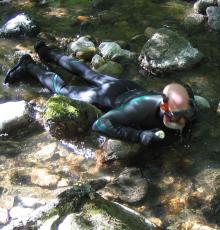
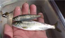
- Biological characteristics, such as abundance and diversity of aquatic plant and animal life and the ability of test organisms to survive in sample water.
When and where monitoring happens depends on the question. Here are examples of monitoring approaches
- regular sites on a regular basis to track change over time
- selected sites for short period of time to answer specific questions
- temporary or seasonal basis to track seasonal phenomenon (e.g. fish migration)
- after an emergency, such as after a wildfire or flood.
Increasingly, monitoring efforts are aimed at determining the condition of entire watersheds -- the area drained by rivers, lakes, and estuaries.
Monitoring can be conducted for many purposes. Five major purposes are to:
- characterize waters and identify changes or trends in water quality over time;
- identify specific existing or emerging water quality problems;
- gather information to design specific pollution prevention or remediation programs
- determine whether program goals -- such as compliance with pollution regulations or implementation of effective pollution control actions -- are being met; and
- respond to emergencies, such as spills and floods.
Some types of monitoring activities meet several of these purposes at once; others are specifically designed for one reason.
The responsibility to monitor water quality rests with many different public agencies and private entities. State pollution control agencies and Indian tribes have key monitoring responsibilities and conduct vigorous monitoring programs. Many local governments, such as city and county environmental offices, also conduct water quality monitoring. The USEPA helps administer grants for water quality monitoring and provides technical guidance on how to monitor and how to report monitoring results. Some of USEPA's technical monitoring guidance documents are provided through their website.
Other Federal agencies are also involved in water quality monitoring. The U.S. Geological Survey (USGS) conducts extensive chemical monitoring through its National Stream Quality Accounting Network (NASQAN) at fixed locations on large rivers around the country. Its National Water Quality Assessment Program (NAWQA) uses a regional focus to study status and trends in water, sediment, and biota. The U.S. Fish and Wildlife Service, the National Oceanic and Atmospheric Administration, the U.S. Army Corps of Engineers, and the Tennessee Valley Authority are other examples of Federal agencies that conduct water quality monitoring to support their programs and activities. The states, territories, and tribes maintain monitoring programs to support several objectives, including assessing whether water is safe for drinking, swimming, and fishing. States also use monitoring data to
- review and revise water quality standards,
- identify impaired and threatened waters under Clean Water Act Section 303(d),
- develop pollutant-specific total maximum daily loads or TMDLs (calculations of the maximum amount of a pollutant that a waterbody can receive and still meet water quality standards and an allocation of that amount to the pollutant's sources),
- determine the effectiveness of control programs,
- measure progress toward clean water, and
- respond to citizen complaints or events such as spills and fish kills.
Private entities such as universities, watershed associations, environmental groups, and industries also conduct water quality monitoring. They may collect water quality data for their own purposes, or to share with government decision makers. Volunteer monitors -- private citizens who volunteer to regularly collect and analyze water samples, conduct visual assessments of physical conditions, and measure the biological health of waters -- are a rapidly growing contingent providing increasingly important watershed information.
Citizen monitoring is another viable source of monitoring and data collection that relies in a whole or in part on participation by community volunteers, students or non-paid staff. Resources for citizen monitoring and details about the Water Board's Clean Water Team (CWT) program can be found on the California Surface Water Ambient Monitoring Program (SWAMP) website.
The California Water Quality Monitoring Council works with agencies across California to develop specific recommendations to improve the coordination and cost-effectiveness of water quality and ecosystem monitoring and assessment, enhance the integration of monitoring data across departments and agencies, and increase public accessibility to monitoring data and assessment information.
Data collected by state, local and federal agencies and private entities are needed to build the assessments we need to make better pollution control decisions. Without data, we simply cannot know where pollution problems exist, where we need to focus our pollution control energies, or where we've made progress.
Many agencies and organizations maintain computerized data systems to store and manage the monitoring data they or others collect. Perhaps the largest such ambient water quality data system is USEPA's STORET (for STOrage and RETrieval) system. Data collected by state, local and federal agencies and some private entities such as universities and volunteer monitors is entered into STORET. Raw data in STORET can be accessed, analyzed, and summarized by many users and for many purposes.
States, and increasingly, tribes, turn their raw data into information about whether their waters meet water quality standards. States report his information to USEPA every two years. USEPA, in turn, summarizes these state water quality assessment reports, required under Section 305(b) of the Clean Water Act of 1972, into a national Report to Congress called the National Water Inventory.
In addition, a report is available which describes environmental indicators that USEPA and its state, Federal, tribal and private partners will be using to measure progress toward national water quality objectives. Over time, the indicators described in Environmental Indicators of Water Quality in the United States will provide consistent information on water quality trends.
The California Water Quality Monitoring Council's My Water Quality web-portal is a good resource for learning about water quality and its importance. The portal is a collaboration between CalEPA and California Natural Resource agencies.
The California Environmental Data Exchange Network (CEDEN) is a central location to find and share information about California’s water bodies, including streams, lakes, rivers, and the coastal ocean. Many groups in California monitor water quality, aquatic habitat, and wildlife health to ensure good stewardship of our ecological resources. CEDEN aggregates this data and makes it accessible to environmental managers and the public.
This brief introduction has provided a glimpse into the complex world of water quality monitoring. Efforts are currently underway to improve how monitoring is conducted, how information is shared, and how decisions based on monitoring are made.
In 1991, the Intergovernmental Task Force on Monitoring Water Quality (ITFM) was chartered to study the nation's monitoring programs and recommend improvements in monitoring design and implementation. Over 80 federal, state, local, and private organizations composed the ITFM itself and an associated advisory committee. Jointly chaired by USEPA and USGS, the ITFM issued two annual reports and a final set of recommendations for a nationwide water monitoring strategy. Among its many recommendations are:
- developing closer working relationships among organizations that monitor and use water information;
- facilitating the design of monitoring programs that measure progress in meeting clearly stated goals;
- identifying national indicators to answer key water quality questions;
- developing comparable technical methods;
- facilitating data automation, sharing, and accessibility;
- improving quality assurance/quality control; and
- improving assessment and reporting of water quality conditions.
For a list of external links to some of EPA's partners on the ITFM, visit National Water Quality Monitoring Council.
EPA and its partners are working to streamline the water quality monitoring, assessment and reporting process through development of a Consolidated Assessment and Listing Methodology (CALM). The CALM will include:
- guidance on attainment/non-attainment of state water quality standards (covering listing/de-listing decisions under Section 303(d) of the Clean Water Act),
- comprehensive state monitoring coverage,
- presentation of data,
- elements of an increasingly comprehensive state monitoring program,
- causes and sources of impairment, and
- additional sections on discrete types of pollutants such as pathogens, nutrients, sedimentation, and fish advisories.
The benefits of the CALM will be improved decision making on impaired waters, and clearer communication to the public on the condition of waters of the U.S.
Above excerpts taken from the U.S. Environmental Protection Agency
Baseline conditions of the project area should be documented before any work is done in order to compare post-project and long-term site conditions to pre-project conditions. Criteria that could be tracked and periodically compared to baseline conditions to monitor project effectiveness and success and feed into an adaptive management process include: continued absence of eradicated invasive plant species and natural recruitment in the eradication areas by native riparian plant species (to be determined through photo documentation and riparian plant monitoring), and increased presence of native riparian vegetation (to be determined by vegetation surveys).
Periodic or event-driven (following a major disturbance) monitoring of the project area will ensure that any project maintenance needs are noted and corrected in a timely manner. Maintenance requirements could potentially include reseeding the area, and the removal/treatment of resprouts and/or new invasive species that may encroach on the study site.