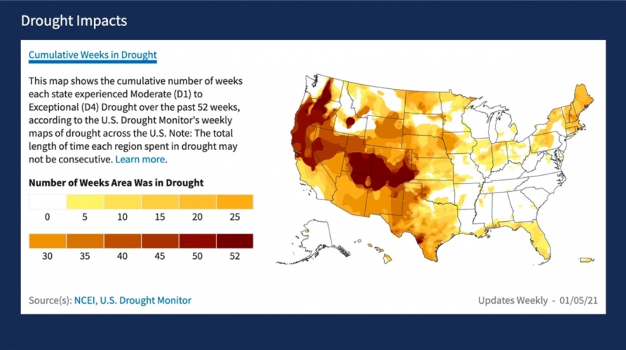
The new Drought.gov site provides new ways of understanding drought impacts, including maps showing how long different parts of the United States have been experiencing drought. Image courtesy the NIDIS project.
New Drought.gov - A One-stop NOAA Resource for All Things Drought
Jan 20, 2021 at 8:00am
NIDIS, NOAA’s National Integrated Drought Information System, has launched a redesigned U.S. Drought Portal to better serve stakeholders, decision makers, the media, and the public.
The new website, Drought.gov, features updated content and new interactive architecture designed to provide actionable, shareable information, and easy-to-understand graphics describing current drought conditions and forecasts by city, county, state, zip code, and at watershed to global scales. Drought.gov aggregates and presents drought impact data for economic sectors such as agriculture, energy, water utilities, tourism and recreation, bringing together interactive maps and data in one place, which you won’t find anywhere else.
Drought.gov has four major new features:
- City and county level conditions
- Historical data and maps
- Sector impacts
- Research and Learn