Groundwater Monitoring
Overview
Given the importance of sustainable groundwater resources in Napa County, long-term, systematic monitoring programs are essential to provide data that allow for improved evaluation of water resources, conditions, and to facilitate effective water resources planning.
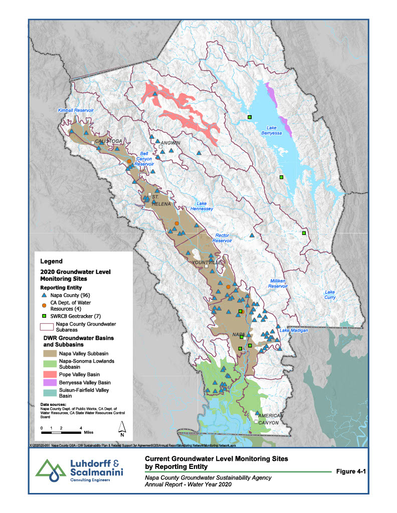
Groundwater data availability in Napa County varies widely among the subareas. The bulk of the historical and current groundwater level and quality data is located in the Napa Valley Floor Subareas. Recent efforts have expanded the geographic extent of data collection to other subareas.
In 2018, the Department of Water Resources resumed monitoring efforts at four wells that had been suspended in response to multiple, large wildfires that burned in many areas around Napa County in October 2017. The majority of these sites were privately owned wells volunteered by their owners and monitored by Napa County. Here is a video that highlights the importance of the program and the data collected.
Groundwater level trends in the alluvial aquifer system of the Napa Valley Subbasin of the Napa-Sonoma Valley Groundwater Basin are stable in the majority of wells with long-term groundwater level records.
Although designated as a groundwater subarea for local planning purposes, the majority of the Milliken-Sarco-Tulucay (MST) Subarea is not part of a groundwater basin as mapped by the California Department of Water Resources (DWR). Groundwater level declines observed in the MST Subarea as early as the 1960s and 1970s have stabilized since about 2009. Groundwater level responses differ within the MST Subarea and even within the north, central, and southern sections of this subarea, indicating that localized conditions, whether geologic or anthropogenic in nature, might be the primary influence on groundwater conditions in this local subarea. The Napa Sanitation District is expanding their recycled water distribution system in the MST subarea. Increased use of this new source of water along with continued land use permitting constraints are expected to aid in maintaining stable groundwater level conditions in the MST subarea in the future.
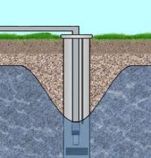
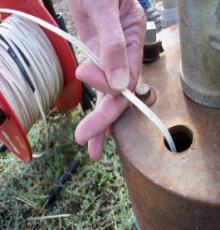
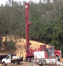
In the past several years, Napa County has developed a more focused understanding of the geology that controls the occurrence and availability of groundwater. With this updated geologic information and with assistance from community members serving on the Groundwater Resources Advisory Committee (2009-2011), the County expanded the number and distribution of wells that it monitors through a concerted effort to improve the understanding of groundwater resources countywide. Between 2011 and 2015 the number of County monitored wells increased from 47 to 100. Presently, Napa County monitors over 100 wells. One new well was added to the network in 2019 in the Calistoga subarea near the margin of the Napa Valley Subbasin where surficial alluvial deposits transition volcanic rock formations. Part of the monitoring network expansion in recent years occurred through the construction of 10 dedicated monitoring wells at 5 sites in Napa Valley, designed specifically to provide data on the interactions between groundwater and surface water.
 |
|
2020 Groundwater Level Monitoring Sites |
Despite the recent monitoring network expansion, there are additional areas where data are lacking and additional wells are needed to fill data gaps. To request more information on options for including your well in the County’s monitoring program, please contact Jamison Crosby, Natural Resources Manager, Jamison.Crosby@countyofnapa.org, (707) 253-4823.
The Basin Analysis Report for the Napa Valley Subbasin provides an updated sustainability goal for the Subbasin based on the requirements of SGMA (LSCE, 2016c). The Basin Analysis Report meets the functionally equivalent standard for alternatives to a Groundwater Sustainability Plan (GSP) in part by updating sustainability criteria for the Napa Valley Subbasin in conformance to the definitions provided in SGMA. To evaluate the condition of the Subbasin in relation to the sustainability goal, the sustainability criteria include measurable objectives and minimum thresholds developed to avoid the six undesirable results identified in SGMA (LSCE, 2016c). For SGMA purposes a “measurable objective” is a “specific, quantifiable goals for the maintenance or improvement of specified groundwater conditions” (Section 351). SGMA additionally defines a “minimum threshold” as “a numeric value for each sustainability indicator used to define undesirable results” (Section 351).
The measurable objectives established in the Basin Analysis Report for the Napa Valley Subbasin provide a reasonable margin of operational flexibility under adverse conditions where applicable and utilize components such as historical water budgets, seasonal and long-term trends, and periods of drought. Groundwater elevations serve as the proxy for multiple sustainability indicators where reasonable. For representative monitoring sites where, long-term periods of record are not available, as in the case of the dedicated monitoring wells constructed in 2014, which were developed specifically to monitor groundwater-surface water interactions, measurable objectives established at these facilities will be reviewed and reevaluated as appropriate, as the collection of available data for each site expands to better reflect true long-term variability at those locations.
Learn more by visiting the Napa County's Groundwater Sustainability Website!
And explore the Groundwater Subarea Maps at this site.